One rewritable 16MB Multi-Media Card (MMC) memory card
MMC/SD memory card reader for PC with USB connector
(parallel port connector optional)
Dynamic Display:
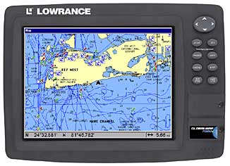
High-brightness 10.4" diagonal (26.4 cm), 640 x 480
pixel, 256-color, full VGA liquid crystal TFT display - 307,200 total pixel
resolution - for exceptional detail and visibility without glare, even in
cockpits and flybridges exposed to sunlight
Brilliant fluorescent cold cathode backlit screen and
keypad for easy readability at night and in low-light conditions
Menu and Pages keys for easy on-screen features selection
Multi full-screen and split-screen navigation charts and
data display combinations
Innovative Memory Card Versatility:
Slots with waterproof doors below the keypad
accept up to two compact, rewritable Multi-Media Cards (MMC) or Secure
Digital (SD) memory cards2 that allow you to:
- Record your GPS trip details - waypoints/events
markers/trails/routes - for viewing on the unit, or loading to PC for
archiving with MMC/SD card reader
- Load custom electronic charts on MMC or SD cards for
navigational display (see Chart Features segment)
- Easily install the latest feature enhancements with
each new operating firmware release that you can download free from the
Lowrance web site
Chart Features:
GlobalMap® 7000c features the all-new, built-in
Lowrance background map with enhanced detail to include over 60,000 critical
nav aids and 10,000 wrecks and obstructions in U.S. coastal and Great Lakes
waters. Also includes new land-based detail such as metro areas, select
major streets/highways and interstate exit services for the continental U.S.
and Hawaii
Included MapCreate™ CD software1 lets you
create unlimited, custom, detailed electronic charts on MMC or SD memory
cards for navigational display, and features unique, searchable database3
of over 700,000 Points-of-Interest that includes marinas, boating-related
services, and more
Compatible with optional Navionics® CLASSIC™ and HotMaps™
electronic charts on MMC cards for select domestic and international areas,
featuring incredible detail including depth contour lines, real-time tide
and current data, port locations with a searchable database of port
services, and other important nav aids
GPS+WAAS Features:
12-parallel channel GPS reception with fast
satellite lock-ons, precise tracking, and position updates every second
Automatic WAAS reception for enhanced position
accuracy to 3 m (under 10 ft) at select locations
High-speed chart screen updates
Mega-memory saves up to 1,000 waypoints, 1,000
event markers, and 100 routes (up to 100 waypoints per route)
10 savable plot trails with up to 10,000 points per trail
42 graphic icons to mark your favorite spots
37 chart ranges from .05 to 4,000 nautical or
statute miles - and 36 ranges from .08 to 8,000 km - with easy zoom-in/out
control
Selective on/off GPS alarms: Off Course, Arrival, and
Anchor
DGPS compatible; interfaces NMEA 0183
Comfort Features:
Internal back-up memory keeps stored settings and
GPS data safe and accessible for years
Man Overboard feature precisely marks MOB location with
special icon, and displays return distance, bearing, track, speed, and
estimated time enroute
External speaker output for remote monitoring GPS alarms
High-impact cover protects screen and keypad when not in
use
Completely sealed and waterproof, even for use in harsh
saltwater environments
Full one-year warranty
Dimensions:
Display - Diagonal: 10.4"/26.4 cm
Case (with bracket) - Height: 9.1"/23.1 cm Width: 12.2"/31 cm Depth:
4"/10.2 cm