|
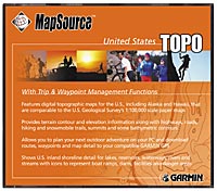
US Topo
 The MapSource™ United States TOPO CD-ROM maps are similar to U.S. Geological Survey 1:100,000-scale topographic paper maps. United States TOPO includes trip and waypoint management functions that allow you to transfer waypoints, routes, and tracks between your PC and nearly all GARMIN GPS units. With MapSource, you can view highways, roads, hiking trails, snowmobile trails, backwoods trails, elevation contours, point elevations, summits, some bathymetric contours, geographic names, churches, and schools. Shoreline detail is included for lakes, reservoirs, small bodies of water, waterways, rivers, and streams. Icons represent boat ramps, dams, marinas, campgrounds, public facilities, mile markers, first-aid stations, picnic, swimming, and ski areas, wrecks, fuel, and dangerous and restricted areas. In addition, nautical navaids for the 50 states are provided, including radiobeacons, RACONs, and fog signals; river, harbor, and other lights; and daybeacons and lighted and unlighted buoys. Wrecks and obstructions—such as shipwrecks, submerged rocks, obstructions, and other hazards to nautical navigation—are displayed. If you have a map download-compatible GARMIN GPS, United States TOPO will allow you to download all the above information directly to your GPS unit.
Suggested Retail Price $151.00
Our Price: $79.00
|
